

Update: Warm evening temperatures continue as a cluster of thunderstorms rumble across Clay County. These are moving slowly toward the east and will weaken as they move over parts of southern Duval and western St. Johns counties.
The showers and storms, some locally heavy, will wind down around 10 to 11 p.m.
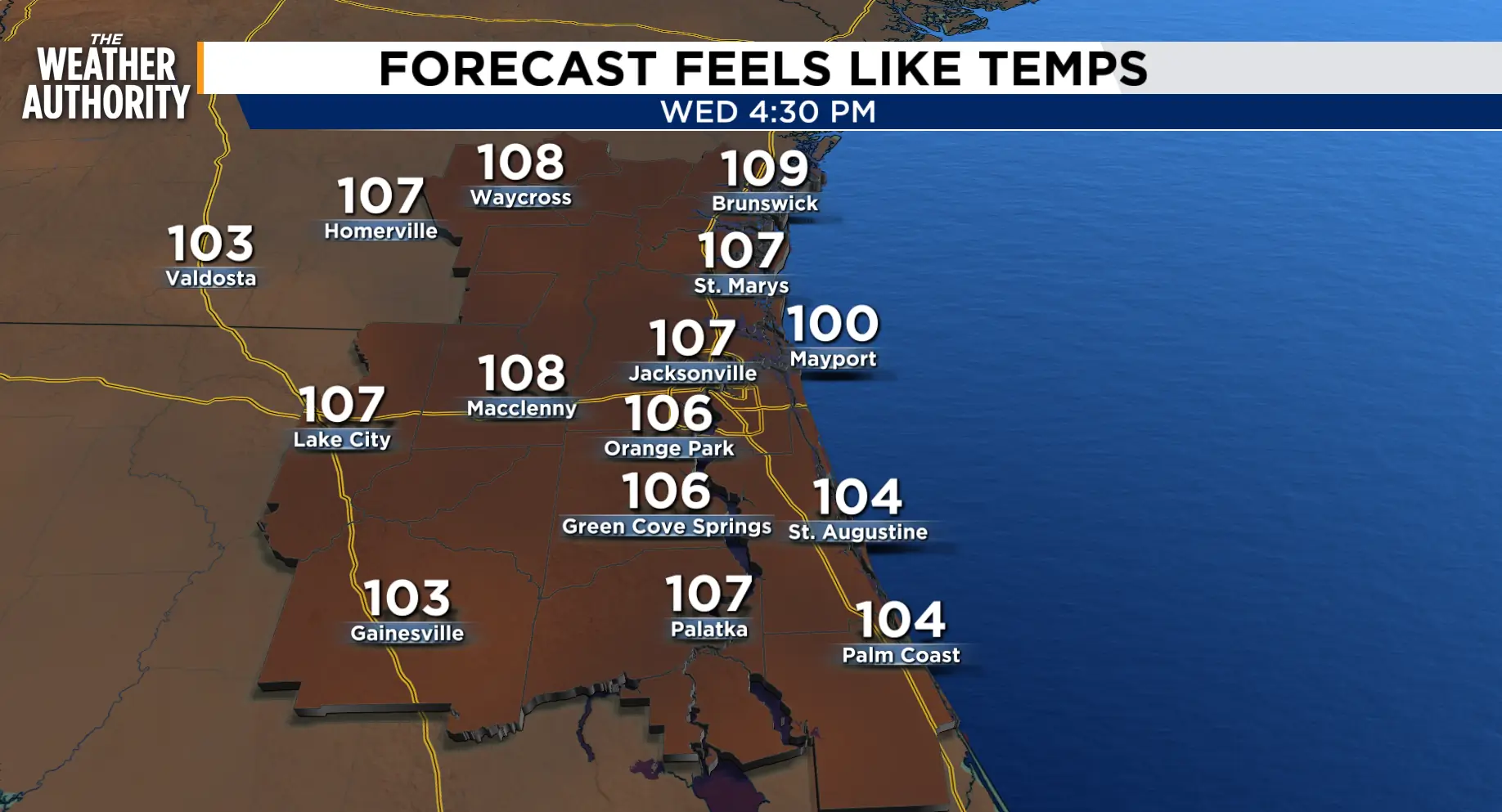
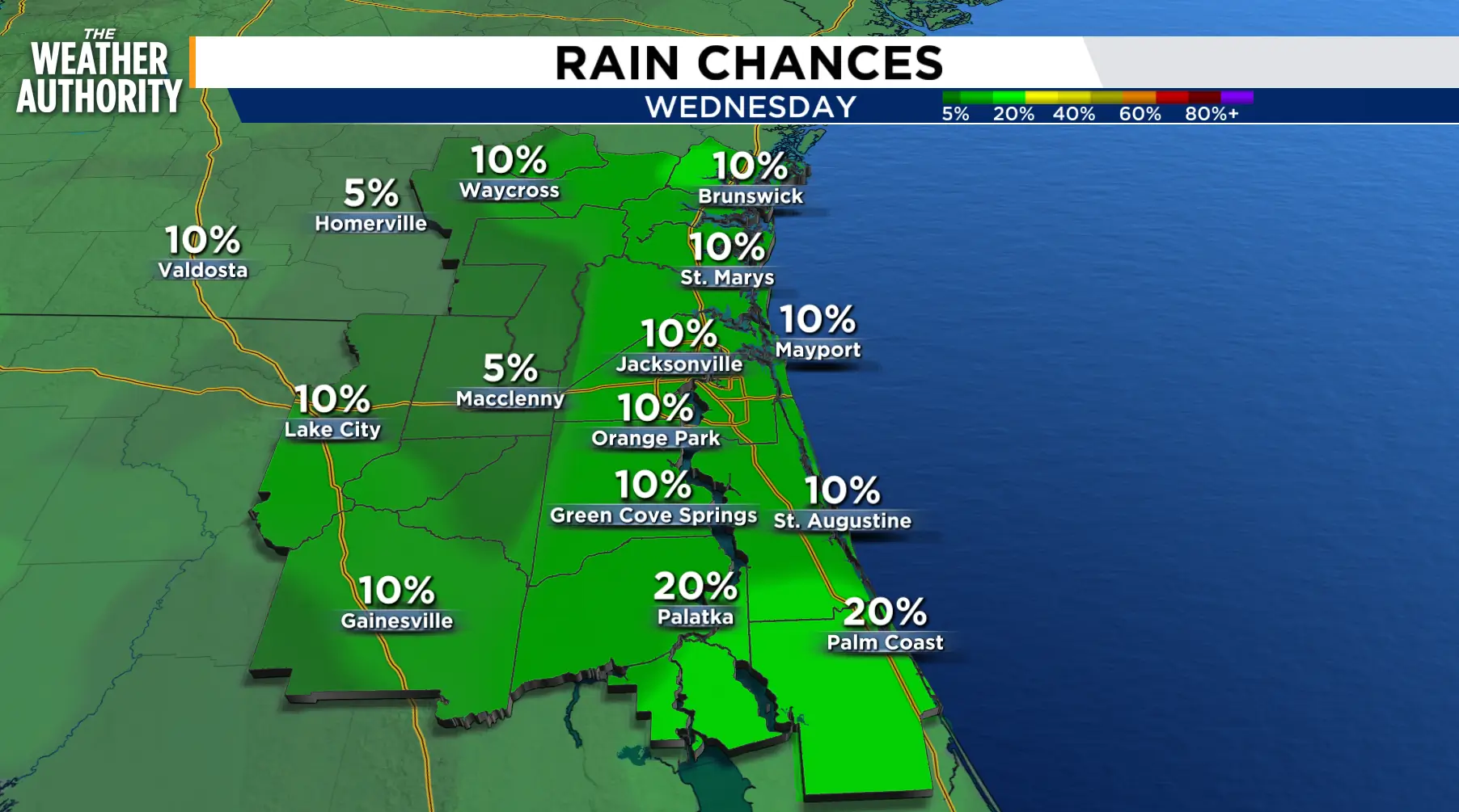
A Heat Advisory has been issued for Wednesday from 11 a.m. to 6 p.m. Afternoon highs will reach the mid to upper 90s, but our bodies will feel like it’s 105-109 degrees. The sea breeze will be the focal point for a few splash-and-dash storms through late afternoon and evening.
The limited rain chances and stifling heat continue Thursday and Friday. Rain chances pick up both Saturday and Sunday, with the unsettled pattern lingering into early next week.
Tonight: Isolated showers and storms, some locally heavy.
Wednesday: Heat Advisory 11 a.m. to 6 p.m. Whew, it’s HOT! Isolated showers and thunderstorms, 20-30 percent. Morning lows in the 70s to 80s. Afternoon highs in the mid to upper 90s inland, 80s to low 90s along the beaches. Wind: SW 5-15 mph. Feels Like temperatures 102-109 degrees.
Thursday - Friday: Our hot and humid summer days continue. Near-record highs with Feels Like temperatures hovering in the triple digits. Rain chances will average 10-20 percent.
Looking ahead: A slight chance of showers returns this weekend, with better chances on Sunday as the heat continues. The unsettled pattern will start the week.
Tropics: No tropical activity is expected over the next 7 days in the Atlantic, Gulf, and Caribbean.
Sunrise: 6:31 p.m.
Sunset: 8:32 p.m.
