


JACKSONVILLE, Fla. – We will see plenty of sunshine today and it will be breezy. Highs this afternoon will be in the upper 70s to low 80s. A beautiful day with lower humidity. An isolated shower is possible, especially along the coast.
Winds could gust up to 30 mph at times, especially along the coast. Coastal flooding will also be possible through the weekend.

Tonight will be mostly clear and pleasant with temperatures in the 50s and 60s.

A strong area of low pressure near New England will continue to push drier air into our region this weekend. This will keep high temperatures below normal (near 80 degrees) along with lower humidity.
Saturday night looks very comfortable with some spots dropping into the 50s!
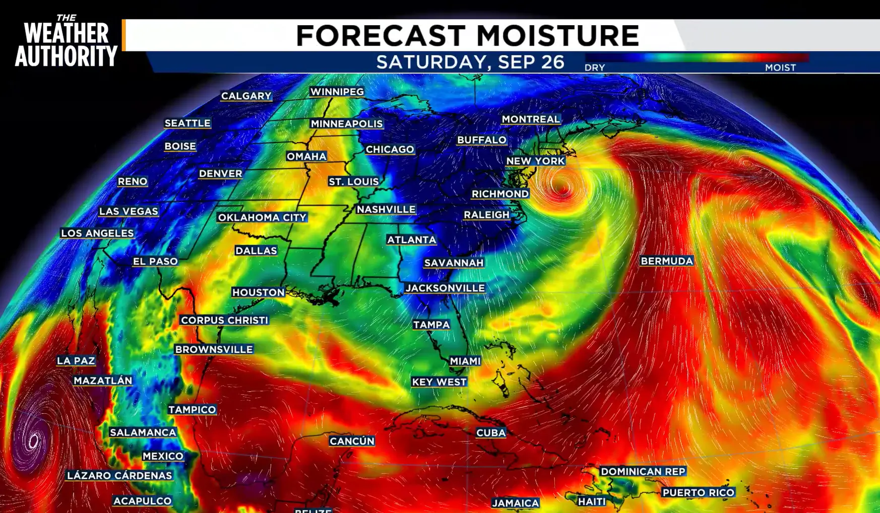
The northerly wind will keep rain and storm chances v due to the drier air overhead. We will see more of the same early next week. Temperatures will climb back into the low to mid 80s by the middle of next week.
Humidity will likely build later next week along with an increase in rain and storm coverage.

Regarding the drought, the latest drought monitor reflects improvement across our area. Several areas have been downgraded to the lowest category which reflects the rainfall we saw over the past week.
While we are still in a deficit, rainfall will once again lead to more improvement in the next outlook.
TODAY: Sun & Clouds. High 80, Low 59.
SATURDAY: Mostly Sunny. High 81, Low 58.
SUNDAY: Mostly Sunny. High 85, Low 64.
MONDAY: Mostly Sunny. High 87, Low 67.
TUESDAY: Sun & Clouds. High 87, Low 70.
WEDNESDAY: Sun & Clouds. Mainly Dry. High 87, Low 71.
