

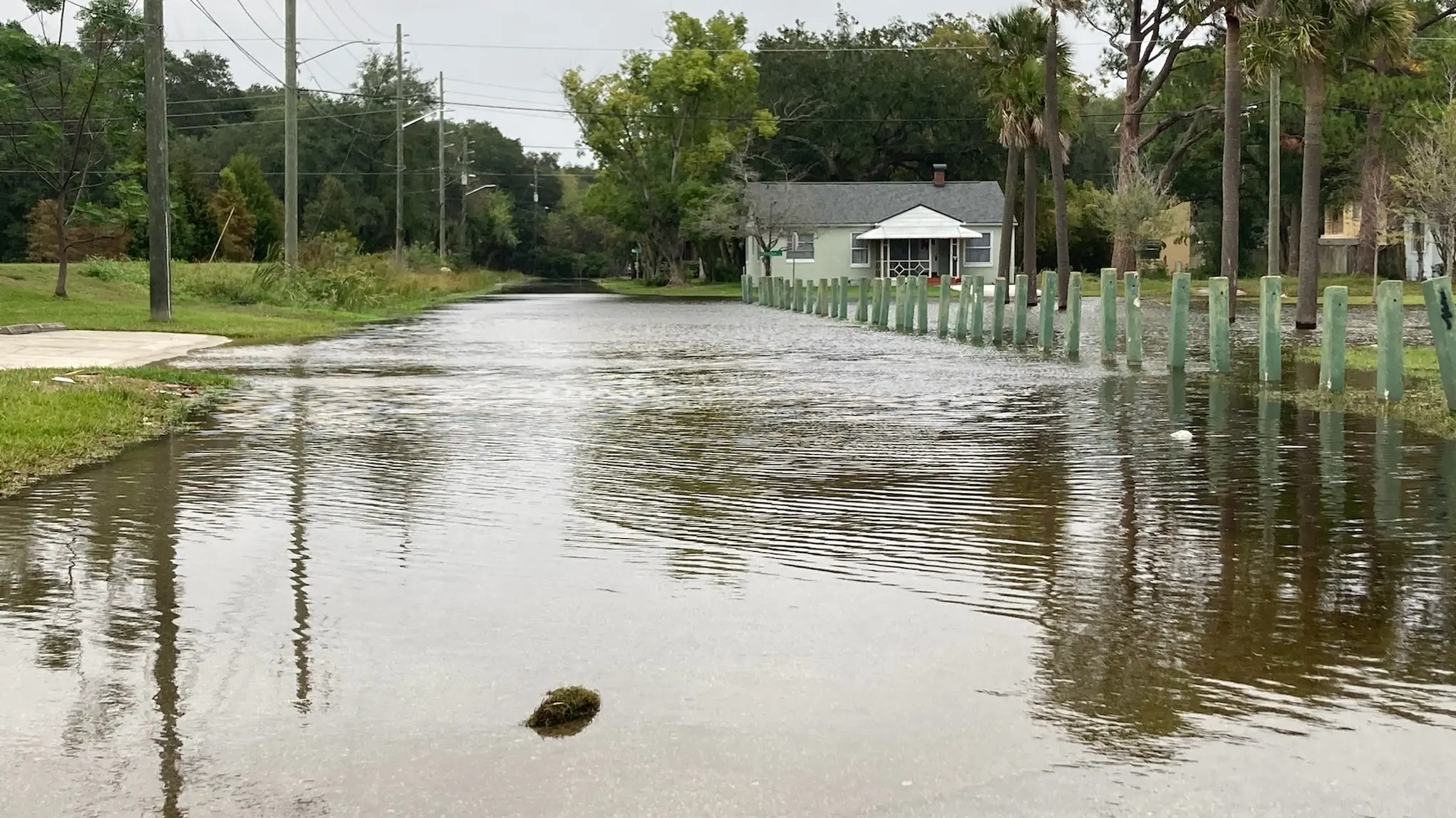
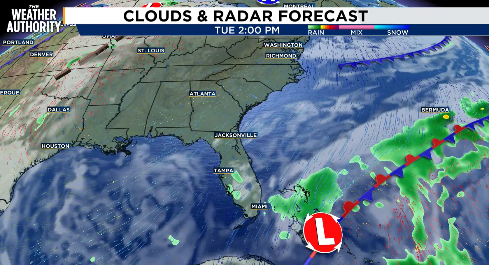
JACKSONVILLE, Fla. – Nor’easter-like conditions persist early this week thanks to an area of high pressure to our north and a developing area of low pressure to our south.
Recommended Videos
Due to the close proximity of these systems, gusty wind will persist over the next few days.
Along with the wind, moderate to major tidal flooding is in the forecast through the end of the week.
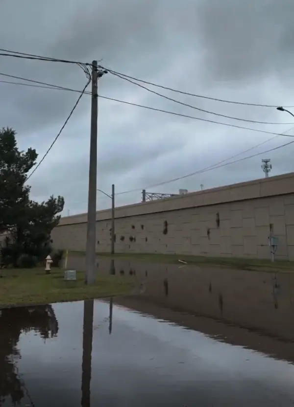
Looking back to last weekend, our area experienced significant coastal flooding with tide levels approaching 2-4′ above normal.
Below are two charts that show the tide level over the past few days in Mayport and Fernandina Beach.
It is worth noting that we experienced the highest tide levels of this Nor’easter event this morning.
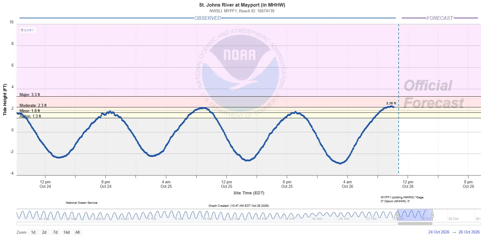
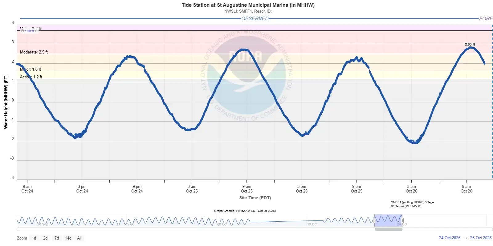
In fact, the official tide stations along the Atlantic Coast at Mayport, FL (MYPF1) and St. Augustine Municipal Marina (SMFF1) both crested Monday morning at the highest water levels since 10/11/2025.
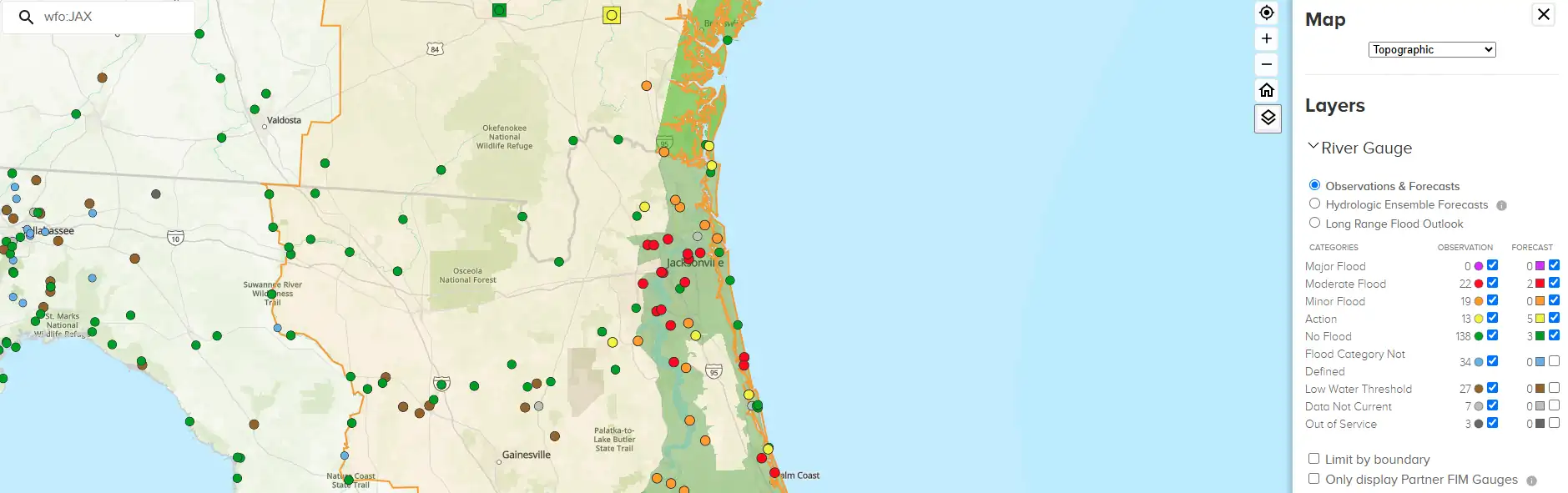
Nearly all gauges in the St. Johns River reached at least moderate flood stage this morning as well.
That’s why it’s important to know that you can still have significant flooding with no rain.
Tide levels will remain elevated over the next few days thanks to the northeasterly wind and an approaching full moon.
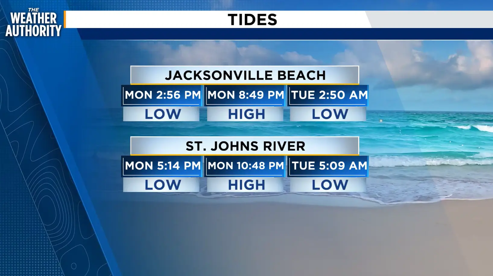
For reference, here are the future tide cycles. Make sure to use caution if you are in an area that’s prone to tidal flooding.
