

The Atlantic basin is showing more activity, with the National Hurricane Center monitoring three separate disturbances.
While none poses an immediate threat to Florida, AL92 central tropical Atlantic is increasingly likely to become a tropical depression.
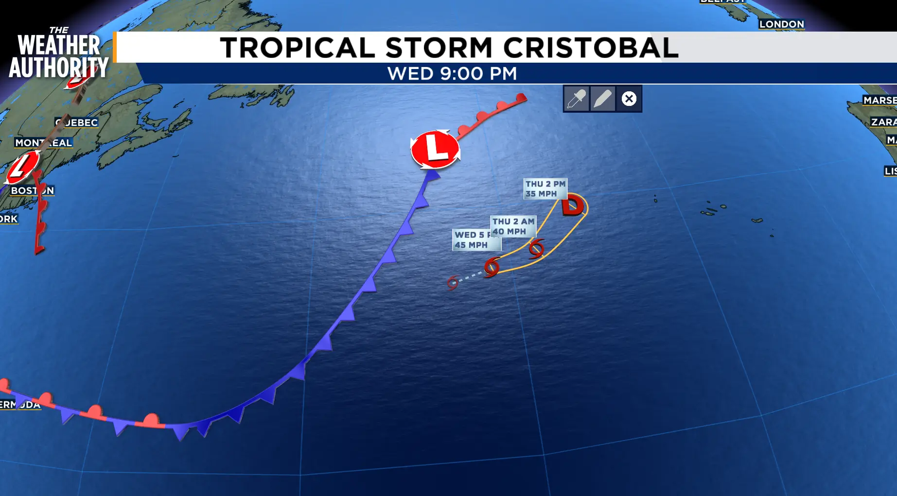
TROPCIAL STORM CRISTOBAL: Cool sea-surface temperatures and north-northwesterly shear are taking their toll on Cristobal. Satellite images show that the cyclone has become completely devoid of deep convection. The initial intensity is brought down to 35 kt for this advisory, as a compromise of the data.
Based on the increasingly harsh environmental conditions that the storm is entering as well as the latest model guidance, Cristobal is expected to continue weakening, and it is unlikely that convection will make a comeback.
The NHC forecast now calls for Cristobal to become a remnant low within the next 12 h.
The center of Tropical Storm Cristobal was located near latitude 37.7 North, longitude 39.5 West.
Cristobal is moving toward the east-northeast near 16 mph.
Maximum sustained winds are near 40 mph.
Weakening is forecast, and Cristobal is forecast to dissipate tonight.
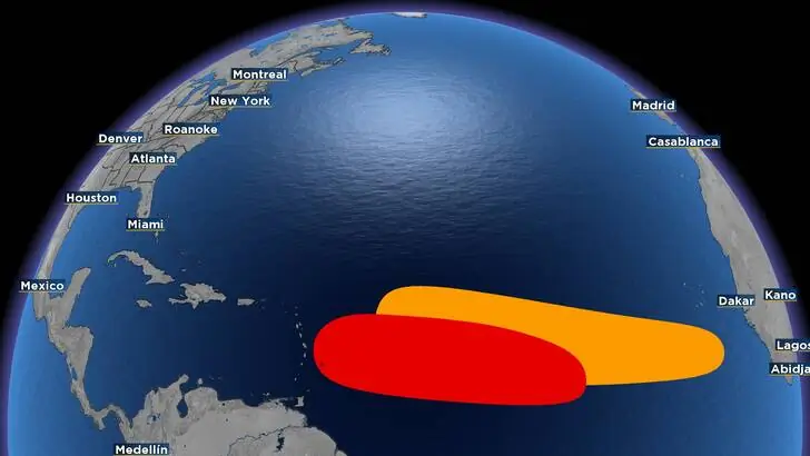
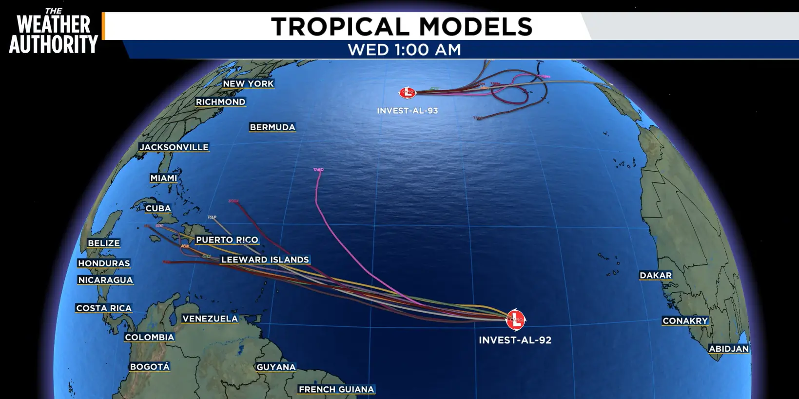
RED SHADED AREA: Central Tropical Atlantic (AL92) is an area of showers and thunderstorms associated with a tropical wave is located about 900 miles west-southwest of the Cabo Verde Islands.
Environmental conditions are forecast to be conducive for development during the next couple of days, and a tropical depression will likely form while the system moves westward to west-northwestward across the central tropical Atlantic.
Formation chance through 48 hours...high...80 percent Formation chance through 7 days...high...80 percent
ORANGE AREA: A tropical wave located several hundred miles south of the Cabo Verde Islands is producing disorganized showers and thunderstorms. Environmental conditions are forecast to be generally conducive for some development of this system during the next several days while it moves westward or west-northwestward across the eastern and central tropical Atlantic.
Formation chance through 48 hours...low...30 percent Formation chance through 7 days...medium...50 percent
One important reminder
The percentages displayed by the National Hurricane Center represent the chance that a tropical depression or storm will form—not the likelihood of a hurricane, landfall or impacts at a particular location. Right now, there is no reason for alarm in Florida, but we are entering the portion of hurricane season when tropical activity typically increases, so checking the forecast regularly is always a good idea.

