

Update: Thunderstorms are moving offshore and winding down over southeast Georgia. Two clusters of storms will continue to weaken over the next hour. Locally heavy rain, gusty wind and lightning will be possible through 11 p.m.
A hot week ahead with daily rounds of showers and thunderstorms.
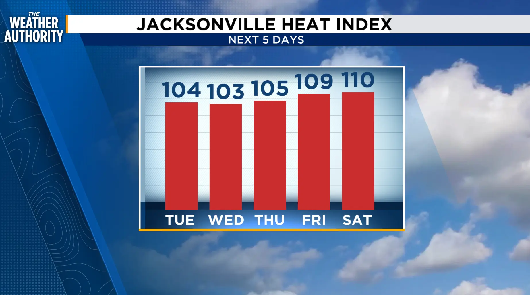
Possible heat advisories Tuesday through Friday with Feels Like temperatures hovering around 102- 110 degrees. Sea breeze showers and thunderstorms will be possible as the wind switches to the southwest.
Along with the Gulf breeze and daily rain chances, we will be watching three potential areas of development in the Atlantic. None of them will affect our forecast and only one of them may become a tropical feature in the Atlantic.
The heat continues this weekend with isolated showers and thunderstorms possible during the afternoon and early evening.
Tonight: Isolated showers and thunderstorms through sunset.
Tuesday: Hot and humid. Possible heat advisories with heat indices up to 110 degrees. Isolated showers and thunderstorms, mainly after 2 p.m., 20-30 percent. Wake up temperatures in the 70s. Afternoon highs in the 90s inland, upper 80s to low 90s along the beaches. Wind: SW 5-10 mph.
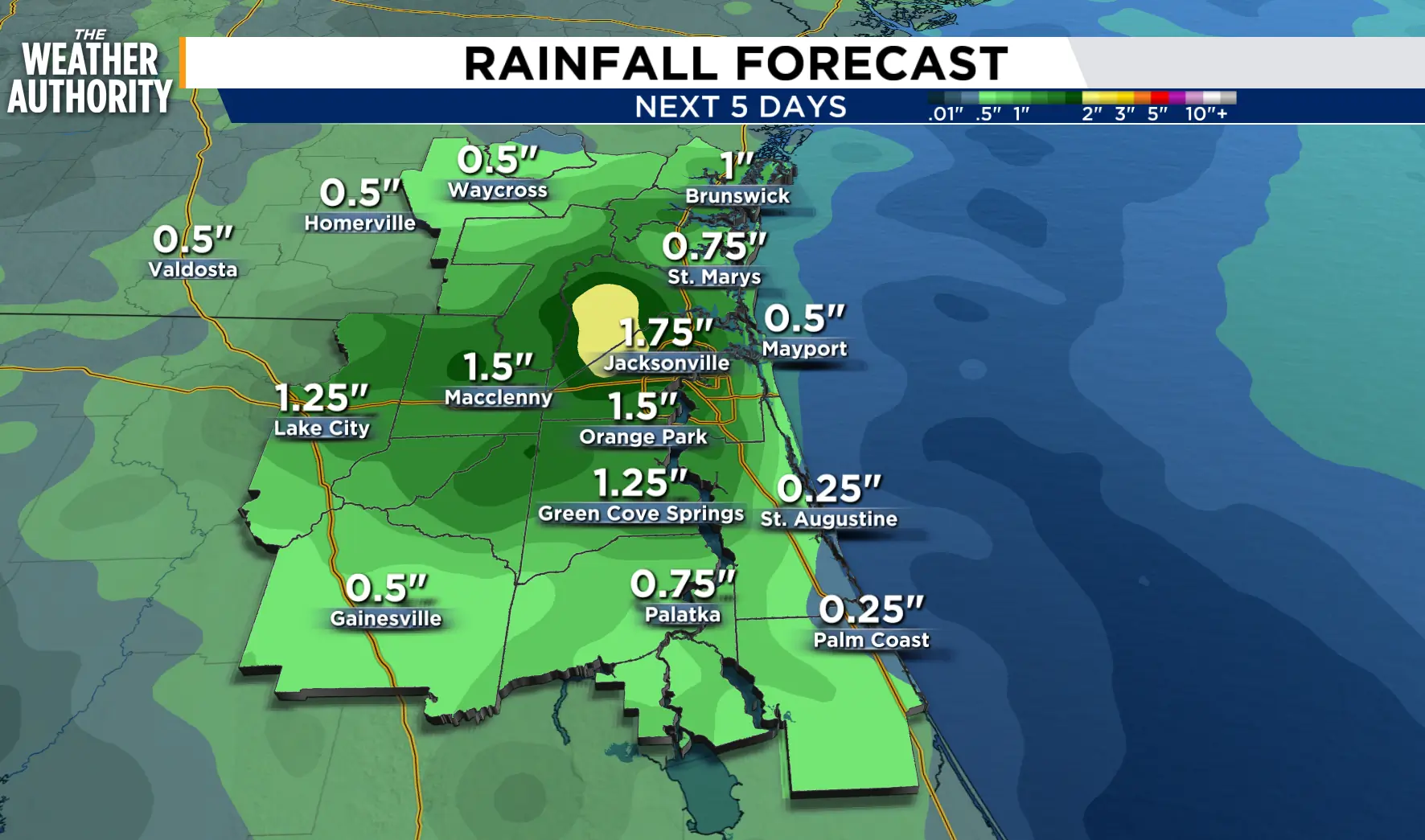
Wednesday - Friday: The heat continues with possible heat advisories. Lows in the 70s, highs in the mid to upper 90s inland, upper 80s to 90s along the beaches. Wind: SW/S.
Tropics: Three areas to watch. None will have an impact on our area. www.news4jax.com/weather/2026/08/10/lets-talk-about-the-tropics/
Sunrise: 6:51 p.m.
Sunset: 8:12 p.m.
