

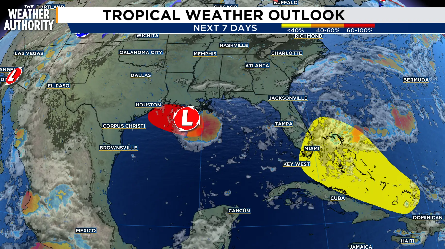
We’re watching two areas in the tropics this morning, but neither brings a direct tropical threat to Northeast Florida or Southeast Georgia today.
In the northern Gulf, Invest AL97 is becoming better organized south of Louisiana.
Gradual development is expected as it moves west-northwest, and a short-lived tropical depression or tropical storm could form before moving toward the Upper Texas or southwest Louisiana coast Tuesday or Tuesday night.
Development chances are high at 70% over the next 48 hours and 7 days. The next named storm would be Edouard.
Closer to the Atlantic side, the remnants of Tropical Storm Dolly remain a strong tropical wave producing showers and storms from Puerto Rico eastward across the Virgin Islands and northern Leeward Islands.
There is no closed surface circulation right now, and redevelopment is unlikely over the next day or two as the wave races west to west-northwest around 25 mph.
By midweek, conditions may become a little more favorable as the system approaches the Gulf. Formation chances remain low: near 0% through 48 hours and 20% through 7 days.
For us, Dolly’s remnants could still have indirect impacts even without redevelopment.
The passing wave may help increase tropical moisture and upper-level support later this week, which could boost rain coverage, lead to stronger afternoon storms, and keep an elevated rip current risk at area beaches depending on the pressure gradient and any longer-period swells reaching the coast.
