

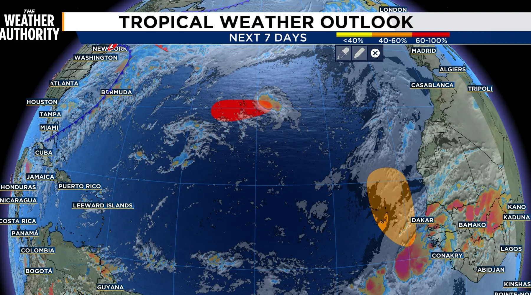
Fay may make a come back. Showers and thunderstorms associated with the remnants of Fay are becoming better organized and further development is possible.
In the central Subtropical Atlantic, showers and thunderstorms have increased with the remnants of Fay located several hundred miles southwest of the Azores.
While environmental conditions are marginally conducive for development and this system could become a tropical depression again today or tonight if the current thunderstorm activity persists.
The system is forecast to move westward during the next couple of days, and by the weekend upper-level winds should inhibit formation chances.
The formation chance through 48 hours and 7 days is now 70 percent.
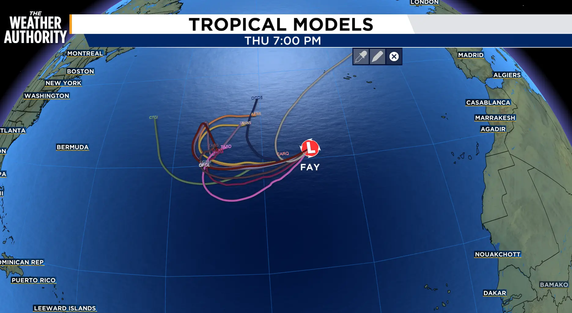
The area of low pressure in the eastern Tropical Atlantic is now Invest 90.
The area of low pressure located a couple of hundred miles southwest of the coast of western Africa is gradually becoming better defined and the associated shower and thunderstorm activity has increased since yesterday.
This system could become a short-lived tropical depression on Thursday or Friday while it moves northwestward to northward.
Strong upper-level winds should end the opportunity for development by the weekend.
The formation chance through 48 hours and 7 days is 50 percent.
